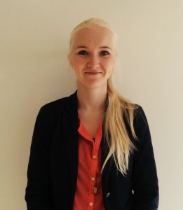
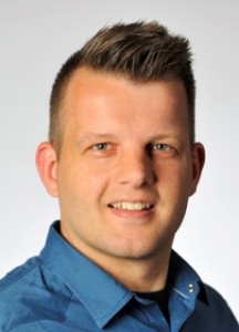
Joris van den Berg
MSc topic: Towards a Dynamic Isochrone Map: Adding Spatiotemporal Traffic and Population Distribution Data
To analyze the number of people who have access to a given area or location within a given time, two spatiotemporal variations should ideally be taken into account: (1) variation in travel time, which tend to differ throughout the day as a result of changing traffic conditions, and (2) variation in the location of people, as a result of travel. Until recently, we lacked insight in where people were located throughout the day. However, as a result of new data sources like GSM data, the opportunity arises to investigate how variation in traffic conditions and variation in people’s location influences accessibility through space and time. The novelty of this research lies in the combination of spatiotemporal traffic data and spatiotemporal population distribution data presented in a dynamic isochrone web map.
Greta Ferloni
MSc topic: Exploring Place and Identity through Soundscape Mapping
With the age of globalisation and information, interactions between people, places and cultures have significantly intensified, generating new forms of sense experiences and complicating our bodily encounters and identities. This research seeks to embrace the call for research that appreciates the significance of sound in relation to place and identity by producing an account which focuses on the aural experience that explores the identities that characterise a place, and its analysis through geospatial visual methods.
The results of the data collected produced insight into sense of place in relation to soundscape that was organised into three main themes: contrasts, temporality and individuality. First, within the theme of contrasts, there is a perceived contrast in wealth within the town of Colwyn Bay. Second, within the theme of temporality, participants reported that the way in which they relate to Colwyn Bay is not constant at any moment, but follows particular rhythms. Finally, within the theme of individuality, it can be observed that each person’s sense of place is heavily based on individual assessments and emotional attachments to aspects in their surroundings, specifically, the soundscape.
Kai Passier
MSc topic: Making open geo-data attainable for everyone
The goal is to investigate how open geo-data can be made attainable, and not only for the experienced users. It is discussed which impediments are present concerning the usage of open geo-data and which requirements a geoportal should have to resolve these impediments. These requirements are implemented in a newly developed geoportal and this geoportal is evaluated with laymen. These laymen are asked to fill in a questionnaire and come up with (other) impediments and requirements. Finally, a list of impediments is formulated and a list of requirements to tackle these impediments.
Pinar Balci
MSc topic: Route Choice Preference of Cyclists: an agent-based simulation model for the city of Utrecht
The objective of this research was to develop a simulation model of cyclists` route choice preferences by using an agent-based model and to utilize measured GPS data to realize this goal. This research serves an informative guide and a repeatable approach regarding creating an agent-based modeling of cyclists route-choice preferences. It provides innovative features for the agent-based modeling of cyclists and urban planning domain. The study seeks to determine the underlying reasons for route choices made by cyclists and tries to implement these reasons as the parameters of cyclist agents route choice behavior in the agent-based model, on the given bike road network.
Swarish Vinaash Marapengopi
MSc topic: Reusability of volunteered geographic information supported by Semantic Web technologies: a case study of environmental applications.
Structuring volunteered geographic information by developing a domain ontology for environmental applications.
Bestoon Mahmoud
MSc topic: Assessing the Usability of Municipal Spatial Data Infrastructure
The overall objective of this research was to assess the usability of municipal SDI from the user perspective in support of the municipal goals. Currently such an insight in the usability of municipal SDI’s is missing.
This research found that evaluating GIS (Geographic Information System) is the best method to assess users’ perspectives in the municipalities. As GIS is the window by which users look through at SDI and GIS considered as the underpinning technology for SDI. It has a significant role in facilitating data collection and storage as well as facilitating decision-making based on spatial data processing and analysis.
The readers will also find a description of the municipal SDI situation depending on the five Geowares concept (Humanware, Dataware, Orgware, Software and Hardware) applied on the study area.
The assessment results encourage municipalities to invest more in developing their SDI to support the purposes of using spatial data (meeting legal obligations and government requirements (laws), supporting municipal business processes and better communication with the residents). This method can be applied to aid in the development of GIS and SDI within a local government. This research leads the way to further researches in this field as well.
Maarja Mahlapuu
MSc topic: Assessing the address data harmonisation process and interoperability in European Union
The European Union (EU) has the INSPIRE initiative to order member states to harmonise address data. The overall objectives of this research are to assess the progress of address data harmonisation in the EU and to investigate if and to what extent current systems are in line with INSPIRE. The results of this research show, that address systems in EU are moving towards better harmonization. The compliance with INSPIRE technical requirements of address system between 2014 and 2017 has been positive. Address datasets and their metadata are more compliant. Countries have made more web services available.
Oscar Ribberink
MSc topic: Standardization of geo data exchange between network operators and contractors in underground utilities
The research question was “How can geo data exchange between utility distribution network operators and contractors be standardized, both for information data models and for communication protocols?”. The methodology included the definition of use cases to help limit the scope. During literature research existing data models and techniques were studied. One of the goals was information model reuse.
The resulting data model was based on IMKL2015 and WFS-T was used as main communication protocol. To demonstrate and evaluate the system design a prototype was developed, consisting of a server and client web application. For use in practice some further research is advised.
Carline Amsing
This research explores the potential of smart sketchmaps for delivering fit-for-purpose land administration in Eastern Africa. It does this by assessing whether smart sketchmaps include the fit-for-purpose land administration elements according to different stakeholder perceptions. Whilst the use of sketch mapping itself is not new in land administration, smart sketchmaps’ technologies and processes allow for conversion of hand drawn sketch maps into topologically and spatially corrected maps. Smart sketchmaps can provide qualitative spatial information in areas where conventional cartographic and geospatial knowledge is often limited. Including these maps in the land administration system not only adds to existing data about visible boundaries, but importantly introduces records of those less obvious socially or temporally constructed de facto boundaries that are significant in customary tenures.
Pim Speel
MSc topic: Action spaces: a GIS based analysis.
One of the main problems the Galapagos Islands are facing are the changing mobility patterns of the population, from environmental friendly methods (foot, bicycle) to environmental unfriendly (taxi, car and bus). The assess the GPS based definition of community action space by analyzing spatial-temporal patterns of the Galapagos Island population.
This research uses the Local Indicators of Spatial Association (LISA) and the Kernel Density Estimation to analyze the action space of 38 volunteers living in three different cities on the Galapagos Islands to assess the use of community action space for research on group mobility and movements within an urban environment.
Jennifer Oldfield
MSc topic: Working with Open BIM Standards to Source Legal Spaces for a 3D Cadastre.
The research focussed on how best to structure an IFC file for inclusion in a 3D GIS Cadastral Database. It was a multidisciplinary project with twin methodologies – one from BIM and the other from GIS. The BIM methodology, which involved first defining the problem through means of a workflow, inspired a new area of research for the LADM ISO 19152 – its own workflow. The subset of the IFC was defined as a data model in STEP and was illustrated in a number of use cases. These CityGML LOD2-like shapes were appropriate for inclusion in a GIS database. They could not, however, have been generated from aerial photos and thus show the unique challenges of creating a 3D legal space overview map.
Hester Bijen
PPGIS in spatial and urban planning can be used to gain insight in public desires, needs and expectations, though it is mainly used for information delivery. Online PPGIS (tools: VGI and 3D geo-information) offer the possibility to combine Interaction (ICT), Technology (GIS) and Local Knowledge, though their added value needs to be proven. The research question therefore was: “To what extent is an online PPGIS environment of added value to the spatial planning process, by using VGI methods and 3D geo-information?” Results were obtained at two case studies within the municipality of Rotterdam, using the usefulness framework of Pelzer (2015) to compare the online PPGIS environment to a public hearing. Results showed that although the public hearing is appreciated by citizens, added value can mostly be found in the complementary use of both participation methods. Furthermore, an Online PPGIS environment can only be successful if support, trust, availability and accessibility have increased at the municipality of Rotterdam. In addition to the usefulness framework of Pelzer, a befor-design study (desire fit) and an after-application study (test of implementation) are proposed.
Patrick van den Ende
The research problem was to examine the possibilities of modelling air pollution concentrations in cities outside Europe at a high spatial resolution. This was done by using a PM2.5 land use regression equation which was developed in the ESCAPE (European Study of Cohorts for Air Pollution Effects) project for the city of London. This equation was applied to Bangkok and Mexico City. To a certain extent it was possible to model air pollution concentration with global datasets. There were not many large errors in the predication. Local calibration is a suitable solution to take city-specific characteristics into account.
Sietske Tjalma
MSc topic: An agent-based model to compare vaccination strategies for pertussis in the Netherlands.
 Since 1996 a resurgence of pertussis has occurred in the Netherlands. In this thesis a comparison is being made between to vaccination strategies via a hybrid model: maternal vaccination strategy and network vaccination (interventions in locations that form important nodes in a network of population movement). According to this model, the best way to reduce the total number of infections in the population is by vaccinating a large population in Amsterdam, or Rotterdam, two of the biggest cities of the Netherlands. Vaccinating in smaller amounts, but all over the Netherlands slows pertussis diffusion down, which can buy time to start targeted interventions at non-infected places. With these model outcomes it is not possible to identify one of the vaccination strategies as best. But the model proved the possibility of modelling spatial diffusion of a disease, which shows potential to look further into modelling spatial diffusion of pertussis.
Stijn van der Hoek
MSc topic: Agent-Based Modeling of leprosy infections. 
Problem: at which contact groups of infected individuals should a targeted approach using rifampicin prophylaxis be aimed to be most effective on the long term? Result: this is dependent on the prevalence rate in the study area. In a high prevalence rate scenario an initial blanket approach, followed by a target approach aimed at both household and neighbor contacts of infected individuals is the most effective. For leprosy, the effectiveness of a targeted approach increases with a decrease in the prevalence rate.


