Here you can read the stories of three current GIMA students. Their experiences can help you to get a better idea of what you can expect of the Master programme.
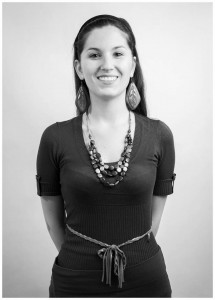
Alina Korman
 I obtained an engineer degree in Spatial Development in Poland. During my studies, the Netherlands was many times presented as an example of innovative solutions and good practices in the world of geo-information (GI). That is why I thought about looking there for a Master programme that would extend my knowledge and give me a worldwide recognized diploma in this field. I had a look on many websites of leading Dutch Universities, but the GIMA programme got my biggest attention. The reason for that was simple: GIMA provides various courses and the best professors from four universities in the Netherlands. I started GIMA in 2013. During the first year I could visit all of them, getting familiar with the staff and the projects at these locations. I have met a lot of interesting people and got connections with highly qualified professionals in GIS. Besides this, it was a great opportunity to travel and explore the country.
Apart from the great content of courses, I also learnt a lot about working together as a team during the GIMA programme. There are many projects where students have to cooperate within a group. I was quite worried about this at first, but it was really unnecessary. In every project people became real friends and I could always count on their professional attitude, positive thinking and enthusiasm. Blended learning was never problematic for us. As a team, we met on Skype and Google Hangout, discussing many times not only project issues but also our life problems. This all was a great, new experience for me.
Currently, being a second year GIMA student, I am writing my thesis while I live in Poland! I have to admit that GIMA is very much suitable for this, because of the distance-learning opportunities. I meet my supervisor on Skype and only had to visit the Netherlands two times. Everything is going very well and I am planning to come in July to defend my thesis. For my internship I also found a great place in the University in Wroclaw (my home city), where I am participating in a very interesting research.
After finishing GIMA, I should have no problem for finding a good GI-oriented job in my county, but I am also considering the possibility of staying at the University for doing further research.
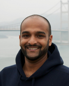
Swarish Marapengopi
Having finished two Bachelor studies – one in ‘Business Administration’  and one in ‘Human Geography and Urban and Regional Planning’ – what appealed to me the most about GIMA, as opposed to other geo-information programmes, was the blended learning curriculum and the two year duration of the programme.
During my undergraduate education, I had spent lots of time in collective lectures and performing group projects. The blended learning curriculum allows you to tackle most of the problems you encounter independently and to research solutions on your own. When you do need help you can use Blackboard, meet up with fellow students in the GIS Lab in Utrecht, or any other place you want.
Using Blackboard to contact teachers, supervisors or professors might seem cumbersome but it actually allows (or maybe forces you) to think about what you do not understand and explain in writing the things you have already tried. In my opinion it is a good exercise in academic thinking and writing.
Because my previous studies were not or marginally related to Geographical Information Systems, the two year duration allowed me more time to experiment with different methods and techniques that are available in Geographical Information Sciences.
Group projects are an integral part of GIMA; several modules (2, 3, 4 and 6) include group projects. In most cases, you can pick your own group. Only for module 3 you are assigned to a group.
If you spend the prescribed 40 hours a week on GIMA, you will most likely pass all your courses with ease. 40 Hours a week includes both focused and diffused thinking about issues you encounter, reading and revising. However, make sure you have or create an environment where you actually spend this amount of time. Again the GIS Lab in Utrecht or one of the libraries of the other universities in the GIMA programme are great for this.
A laptop is mandatory for GIMA. The minimal requirements are provided when you enter the programme. If you are in the market for a new laptop make sure you check out the ITC Notebook Service Centre (http://www.utwente.nl/icts/en/nsc/) for a deal on a laptop. Do not overspend on or over specify your laptop for basic GIMA operations, the minimal requirements will do.
A drawback of GIMA is the limited amount of contact hours – with both supervisors and peers – during the second year. Also, the amount of international internships, case studies and projects is limited. Furthermore, you are likely to incur a delay in your study if you decide to do your internship before your thesis.
As a final tip: make sure you know what you are getting into! Once you are admitted you will receive a link of the book “Principles of Geographic Information Systems”. Make sure you read it and do additional research. GIMA is not just about making maps, there is scripting (Python), modelling (UML), database creation and management (PostgreSQL/PostGIS), geodesy, remote sensing, and much more involved. You will scratch the surface of all these facets.
Overall, GIMA provides students an academic framework in which students can learn and experiment with facets of Geographical Information Science. As with probably all GI Science programmees you have to make the most of it. The obligatory tasks, projects and reports only provide a partial view of the possibilities and opportunities that GIS provides but you will have to find out which aspects interest you.
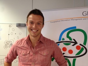
Niels van Beek
 During the Bachelor programme Human Geography and Planning of Utrecht University, I developed a great interest in Geo-information and GIS technology. I was really impressed by the possibilities of GIS and I have always been intrigued by maps. Therefore, I decided to study the Master programme GIMA. My ambition is to have a challenging career in Geo-information technology, in which I will work with advanced GIS technologies and on innovative projects that really matter! GIMA is definitely helping me to prepare myself for such a career. GIMA is a very broad study, which pays attention to the management and application of geo-information. The structure of the GIMA programme is great. During the first year (or the first two years for part-time students), students develop skills concerning the management and application of geo-information. The second year (or third and fourth year for part-time students) of the programme, these developed skills can be used in the MSc thesis module and an internship module.
I performed my MSc thesis at Kadaster (Netherlands’ Cadastre, Land Registry and Mapping Agency). The subject of my MSc thesis is: Using airborne laser scanning for deriving topographic features for the purpose of general boundary based cadastral mapping. Seventy-five percent of the world population does not have access to formal land administration systems, which are able to register their land rights. My MSc thesis focusses on constructing a cadastral map, one of the most important components of a land administration system, according to the general boundary concept, with the use of airborne laser scanning. Topographic features can be derived from airborne laser scanning. These topographic features can be used to determine general boundaries. Subsequently, the general boundaries can be used to determine land parcels. Finally, land rights can be linked to land parcels. The subject of this MSc thesis is a good example of how an advanced GIS technology (airborne laser scanning) can be used for solving a social problem (a lack of a proper land administration).
I really enjoyed my time at Kadaster. Employees of Kadaster International, who share the knowledge of Kadaster with international organisations and government agencies, were really excited about my MSc thesis. This gives me a lot of satisfaction and keeps me motivated to learn more and more about geo-information and GIS. Thanks to the skills I learned during GIMA, I was able to receive this positive comment. I am looking forward to a next challenge, which will be an internship at ARCADIS!


